About the Rock Garden
Why build a field course on campus?
Geoscience field skills training is, for very good reasons, traditionally done in the field. In most cases, it is much easier to take students to the field than to bring the field to students. However, day-long and longer residential field courses are financially costly and time-consuming to run, meaning that there are often long gaps between field courses during a degree programme. The time-gaps between field courses mean that students' field skills can become rusty, or they may lose confidence in their abilities, in the intervening time.
More fundamentally, there are also issues of physical, financial, and cultural accessibility of field courses, particularly where students are expected to stay away from home for extended periods of time. Whilst many professional geoscience graduates may not use their field skills on a regular basis, it is important that they understand the ins-and-outs of field data collection, including the uncertainties involved in producing, for example, a geological map. Accessibility concerns should not form insurmountable barriers to students learning field techniques and the intricacies of field data collection.
We started planning the Rock Garden in 2019, mainly to give current students more opportunities to practise their field skills. Implementation stalled with the coronavirus pandemic in 2020, but the travel restrictions during this time made it even more important to be able to deliver field skills training locally and safely. An on-campus resource like the Rock Garden can be used to mitigate structural barriers to accessing field work training and give students more opportunities to practise and maintain confidence in their field skills.
How we built a field course on campus
We wanted to be able to use the Rock Garden to train as many geological field skills as possible, and we consider that a hypothetical geological mapping exercise would give us the widest range of skills in one activity. Geological mapping uses orienteering, rock identification and description, structural measurements, and geological interpretation. It also gives the opportunity to develop a more holistic field-based research exercise including further lab analysis (e.g. petrology and palaeontology).
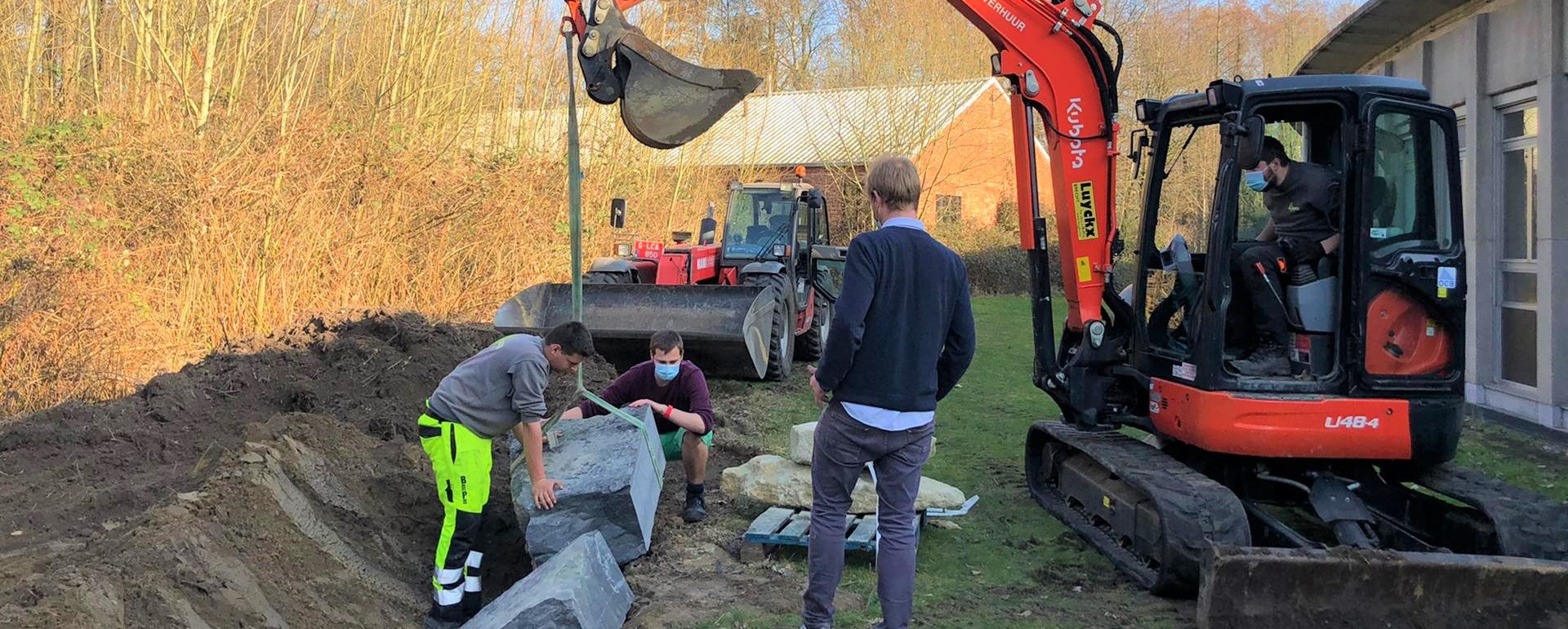
Having settled on a geological mapping activity, we worked with the Ghent University Faculty of Sciences and the Directie Gebouwen en Facilitair Beheer (DGFB) to develop the Rock Garden. We identified areas of Campus Sterre where large blocks could be dug into the ground; collaboration with the DGFB was crucial here to avoid digging through or blocking current or planned utilies access. The predominantly north–south alignment of the available sites meant that an approximately east–west aligned structure was most suitable for the Rock Garden. We designed a hypothetical geological structure to fit the availale area and 'outcrop' sites.
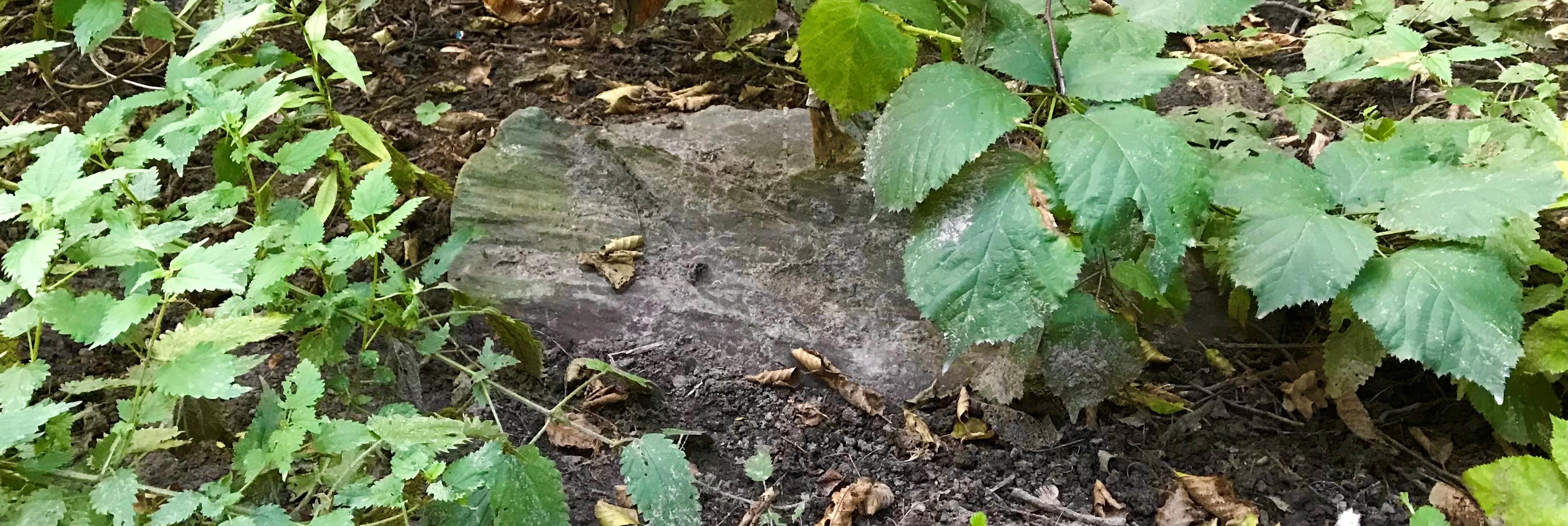
Talking to contacts at local building stone and quarry companies, we worked to find a selection of different local rock types (sedimentary and igneous) that would work with the geological plan. Having selected a range of rock types, we worked with the DGFB to prepare the outcrop sites for the blocks and dig them into the ground. After all blocks were intsalled, we mapped the Rock Garden to see how geologically plausible the actual distribution of rocks was. We made a few minor changes to the orientation of some of the rocks until all were within a couple of degrees of the plan. We do need to continue to monitor the positions of the blocks as they are likely to settle over the next year or so, and we expect to have to make more small adjustments to some of the blocks over the coming months.
The Rock Garden is a work-in-progress and it requires ongoing attention, as does any teaching resource. We aim to add new modules to continue to enhance the didactic capacity of the Rock Garden, including adding a module to incorporate laboratory analyses of field-acquired samples.
What the Rock Garden cannot do
There are limits. The Rock Garden is intended to complement, not to replace, existing field courses. We cannot incorporate substantial topography into the mapping work. The small size and limited number of available outcrop sites means that there is a limit to the complexity of geological structure that can be resolved. The small size of outcrop sites also limits the geological complexity and range of skills usable at each outcrop. The Rock Garden is particularly useful for introducing and honing specific field skills such as measuring planar surfaces, and learning about how these skills are used in geological field work. However, to find a wider variety of structures, lithologies, and outcrop types does require going into the 'real-world' field. We hope that experiences with the Rock Garden will help students maintain confidence in their skills, and will make aspects of field work training accessible to more people than traditional field courses.
Suggestions for further reading
A non-exhaustive list of suggestions for reading up on geoscience field skills.
- Lisle et al. 2011: Basic Geological Mapping.
- Tucker 2011: Sedimentary Rocks in the Field.
- Coe et al. 2010: Geological Field Techniques.
A non-exhaustive list of articles that provide a starting point for learning more about the (in)accessibility of field courses with links to the open access versions of articles where these are available.
- Abeyta et al. 2021: The True Cost of Field Education is a Barrier to Diversifying Geosciences.
- Giles et al. 2020: Barriers to fieldwork in undergraduate geoscience degrees.
- Chiarella & Vurro 2020: Fieldwork and disability: an overview for an inclusive experience.
- Anadu et al. 2020: Ten steps to protect BIPOC scholars in the field.
- Stokes et al. 2019: Making geoscience fieldwork inclusive and accessible for students with disabilities.
Acknowledgements
The Rock Garden has been developed with financial and practical support from the Ghent University. The Faculty of Sciences provided funding for this Active Learning project. The Directie Gebouwen en Facilitair Beheer (DGFB) were invaluable in their support in planning the locations of the blocks and installing them.